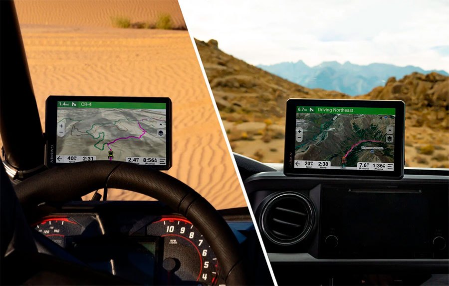
Garmin announced new generation of Tread 2 Overland and SxS navigators
-
in Garmin
-
Hits: 97
Garmin® International announced the Tread® 2 — Overland Edition and Tread 2 — SxS Edition navigators that bring larger, brighter displays, faster performance and additional mapping options to enrich off-road adventures. Both all-terrain navigators feature 8” high-resolution, ultrabright, glove-friendly touchscreens and are purpose-built to withstand extreme temperatures and weather with an IP67 dust/water rating. The Overland Edition comes with a heavy-duty suction cup and robust magnetic-assisted locking mount to secure onto a vehicle’s dashboard, while the SxS Edition includes a tube mount kit for easy install on a powersport vehicle. Adventure seekers will also love using the Great Rides feature1 to find the best off-road places to explore, rate a trail’s difficulty and upload photos of their journey through the Tread mobile app.

Designed for adventure
Boasting vibrant 8” displays, both the Tread 2 – Overland Edition and SxS Edition include robust mapping options and backcountry data to help amplify every detail and waypoint of an off-road excursion.
- Off-road mapping: Find the way with turn-by-turn navigation for unpaved roads and trails with content from OpenStreetMap™, U.S. Forest Service Motor Vehicle Use Maps and Adventure Roads and Trails2.
- Off-road riding areas: Preloaded off-road riding areas throughout North America, shows trail difficulty ratings and more.
- Garmin Adventurous Routing™: Discover alternate routing options for more hilly, unpaved and thrilling routes.
- Satellite imagery: See high-resolution overhead views of routes and terrain that can be downloaded directly to the device via Wi-Fi® technology.
- Land boundaries: Be aware of public land boundaries for national forests, Bureau of Land Management and wilderness areas and view private land boundaries and landowner information for parcels greater than four acres.
- Route planning: Utilizing the Tread app, adventurers can easily plan routes with the same maps, vehicle profiles and route preferences as on a Tread 2 device.
- Custom routing & road warnings: Get custom street routing3 for the size and weight of the vehicle. Plus, receive alerts for potential hazards along the route including sharp curves, steep grades and more.
- Campgrounds: Easily find a place to set up camp with the directory of more than 46,000 camping locations across the U.S.
Boost every adventure
Garmin continues to demonstrate its dedication to the off-road market with a wide selection of rugged devices made to seamlessly connect to Tread 2 navigators. Tread users can elevate off-the-grid overlanding expeditions or thrilling off-road rides with use of additional Garmin devices and plan options (sold separately):
- Premium mapping: Purchase an Outdoor Maps+ plan to receive ongoing access to premium map content, including enhanced TOPO maps for elevation data with maximum detail, night lights to help find the best places for stargazing, burn zones to see where wildfires or controlled burns have happened, Garmin Trails to browse thousands of trails and save to courses and much more.
- Off-grid communication: Pair with a compatible inReach® satellite communication device4 for two-way texting outside of cell coverage and the ability to send an interactive SOS message to Garmin Response℠, a 24/7-staffed international coordination center for help in an emergency.
- Group rides: Stay in touch with group members with the Group Ride Radio accessory, which includes real-time location sharing and voice communication through the included push-to-talk first mic. Use with a Bluetooth® enabled helmet or headset for the option to enjoy hands-free voice communication.
- Digital Switch box: Enable on-screen control of the vehicle’s 12-volt electronics – including light bars, differential locks and more – with a Garmin PowerSwitch™ digital switch box.
- Dog tracking: Use with a compatible Garmin GPS dog tracker to help track and retrieve sporting dogs in the field.
1Requires an active cellular or Wi-Fi connection.
2Limitations may exist in map data for some road and trail route suggestions. Always defer to posted road signs and conditions during vehicle operation. Garmin products using OpenStreetMap data are intended to be used only as supplementary travel aids.
3Not available in all areas. Entering your vehicle’s characteristics does not guarantee your vehicle’s characteristics will be accounted for in all route suggestions. Always defer to all posted road signs and road conditions.
4An active inReach subscription is required. Some jurisdictions regulate or prohibit the use of satellite communication devices. It is the responsibility of the user to know and follow all applicable laws in the jurisdiction where the device is intended to be used.
About Garmin International, Inc.
Garmin International, Inc. is a subsidiary of Garmin Ltd. (Nasdaq: GRMN). Garmin Ltd. is incorporated in Switzerland, and its principal subsidiaries are located in the United States, Taiwan and the United Kingdom. Garmin, Tacx and Edge are registered trademarks and Garmin Connect is a trademark of Garmin Ltd. or its subsidiaries.
